


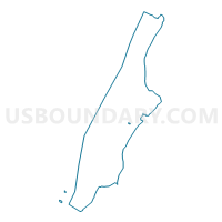
Voting District 6500035, New York County, New York
About
Outline

Summary
| Unique Area Identifier | 632111 |
| Name | Voting District 6500035 |
| County | New York County |
| State | New York |
| Area (square miles) | 0.01 |
| Land Area (square miles) | 0.01 |
| Water Area (square miles) | 0.00 |
| % of Land Area | 100.00 |
| % of Water Area | 0.00 |
| Latitude of the Internal Point | 40.76896230 |
| Longtitude of the Internal Point | -73.95367920 |
Maps

Graphs
Select a template below for downloading or customizing gragh for Voting District 6500035, New York County, New York


Neighbors
Neighoring Voting District (by Name) Neighboring Voting District on the Map
- Voting District 6500029, New York County, NY
- Voting District 6500030, New York County, NY
- Voting District 6500031, New York County, NY
- Voting District 6500033, New York County, NY
- Voting District 6500034, New York County, NY
- Voting District 6500036 6500040, New York County, NY
Top 10 Neighboring County Subdivision (by Population) Neighboring County Subdivision on the Map
Top 10 Neighboring Place (by Population) Neighboring Place on the Map
Top 10 Neighboring Unified School District (by Population) Neighboring Unified School District on the Map
Top 10 Neighboring State Legislative District Lower Chamber (by Population) Neighboring State Legislative District Lower Chamber on the Map
Top 10 Neighboring State Legislative District Upper Chamber (by Population) Neighboring State Legislative District Upper Chamber on the Map
Top 10 Neighboring 111th Congressional District (by Population) Neighboring 111th Congressional District on the Map
Top 10 Neighboring Census Tract (by Population) Neighboring Census Tract on the Map
- Census Tract 126, New York County, NY (12,774)
- Census Tract 134, New York County, NY (11,174)
- Census Tract 132, New York County, NY (10,590)
- Census Tract 124, New York County, NY (10,218)